
Route 6 — Israel's only toll road. 170 km north-south. Derech Eretz concession. Opened 2002. Reshaped commuting and real estate.
Route 6 — officially the Yitzhak Rabin Highway, though almost nobody calls it that — is Israel's only toll road and the single infrastructure project that most reshaped the country's commuting patterns, real estate values, and peripheral-city accessibility. A 204-kilometer north-south expressway running along the eastern interior, bypassing the congested coastal strip between Tel Aviv and Haifa.
The Basics
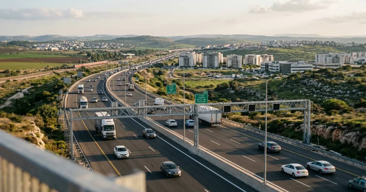
Fully electronic free-flow tolling — no booths, no stopping. Cameras, transponders, and automatic license plate recognition handle billing. The technology is based on Ontario's Highway 407 system, developed by Raytheon. Three lanes in each direction. Interchanges connecting to Hadera, Netanya, Kfar Saba, Rosh HaAyin, Shoham, Modi'in, and Kiryat Gat, among others.
The highway's kilometer markers begin at 30 to account for planned southern extensions that have not yet been built.
Construction and Timeline
Route 6 was built in stages over nearly two decades:
2002: First section opened. The initial segments connected the central population belt — Rosh HaAyin, Shoham, and the approach to Modi'in — to the existing highway network.
November 2016: Southern terminus opened at the Shoket Interchange, extending the highway deep into the northern Negev near Be'er Sheva.
November 2018: Northern terminus opened at the Tel Kashish Interchange, stretching the road into the lower Galilee.
2019: Northern extension reached the Somech Interchange, bringing the highway to its current 204-kilometer length.
The construction model was a BOT (Build-Operate-Transfer) concession — a 30-year franchise awarded to Derech Eretz Highways. Derech Eretz financed the construction, built the road, and operates it. At the end of the concession period, the asset reverts to the State of Israel.
Toll Rates
Pricing is segment-based. As of the most recent published rates, a full-length trip costs roughly 28 NIS for registered transponder users and more for unregistered vehicles billed by license plate. Discounted rates apply for subscribers; the highest rates are charged to vehicles without a transponder account.
Several sections are toll-free: everything south of the Sorek Interchange, the stretch between Ben Shemen and Daniyyel (concurrent with Highway 1, the Jerusalem–Tel Aviv highway), and parts of the western Jezreel Valley section that run concurrent with Highway 70.
Traffic and Revenue
By 2005 — just three years after opening — Route 6 had more than 500,000 registered subscribers and recorded 21 million trips in a single year. Eighty percent of trips were made by subscribers. The bill collection success rate hit 97 percent.
By 2006, the road reported 89 million NIS in profit on 779 million NIS in income — a 56 percent and 137 percent increase, respectively, over the prior year. The road became profitable faster than almost any comparable toll infrastructure project globally.
The Concession: Derech Eretz
Derech Eretz Highways holds the concession for the central and southern sections. A separate operator — branded as "6 – Northern Crossing" — manages the tolled northern sections independently.
The concession was controversial from the start. Critics argued that peripheral communities — those with the fewest alternative routes — bore a disproportionate cost. A commuter in Kiryat Gat or Hadera who needed Route 6 to reach the center of the country had no free alternative of comparable speed. The toll effectively functioned as a tax on living in the periphery, which was the opposite of the stated national policy of encouraging peripheral development.
Derech Eretz is backed by the Israel Infrastructure Fund (IIF), one of the country's largest infrastructure investment vehicles.
Economic Impact
Route 6 transformed inland Israel's economics in ways that are still unfolding.
Modi'in. The city — now home to more than 100,000 residents — would not exist in its current form without Route 6. Built in the 1990s as a planned city between Tel Aviv and Jerusalem, Modi'in's growth depended entirely on highway connectivity. Route 6 made it commutable to both metros.
Haredi satellite cities. Modi'in Illit and Beitar Illit — two of the fastest-growing cities in Israel — became viable residential communities because Route 6 (and the connected Highway 443) made them commutable to employment centers. The highway accelerated a demographic pattern that reshaped Israeli politics and housing markets.
Commute reductions. Communities east of the coastal strip gained 30 to 60 minute commute reductions to the Tel Aviv metropolitan area. Before Route 6, the only north-south corridor was Highway 2 along the coast and Highway 4 through the Sharon plain — both chronically congested.
Real estate. Property values in towns along the Route 6 corridor — Rosh HaAyin, Shoham, Kfar Saba's eastern neighborhoods — rose significantly in the years after the highway opened. The road redefined which locations counted as "commutable" to Tel Aviv.
Future Development
In July 2025, Transportation Minister Miri Regev proposed a NIS 5 billion (approximately $1.48 billion) elevated highway project: 48 kilometers of elevated lanes above the most congested sections of Route 6. The plan calls for 16 kilometers of elevated road between the Nahshonim and Eyal interchanges and 32 kilometers between the Baqa-Jatt and Horshim interchanges. The proposal reflects the fact that Route 6 — built to relieve congestion on the coastal highways — is now itself congested during peak hours.
Political Context
Route 6 is officially named the Yitzhak Rabin Highway, after the assassinated prime minister. The name is rarely used in everyday speech — Israelis call it Kvish Shesh (Highway Six) or the Cross-Israel Highway. The naming was a political gesture that did not stick in public usage, similar to the Ben Gurion Airport naming (universally called "Natbag" in Hebrew acronym).
The highway runs near the Green Line in certain stretches, which generated political controversy during construction. Its eastern routing was partly a strategic choice — placing a major transportation artery along Israel's narrow waist — and partly a practical one, since the coastal plain was already built out.
Related
- Israel Railways
- Israeli Infrastructure